Overland Fire Incident Resource Page
Page created: June 21, 2021
Information per CAL FIRE
Start Date: June 19, 2021
Initial Location: Canebrake Canyon Road and Great Southern Overland Stage Route , East of Mount Laguna
Initial Lat/Long: 32.903917, -116.233056
Fire Map
Air Quality & Smoke Links
US Forest Service BlueSky Daily Runs – Smoke Modeling
US Forest Service BlueSky Daily Runs KMZ and Map Files
AirNow EnviroFlash Map (includes alert notification signup option)
Weather
National Weather Service Watches, Warnings, and Advisories
 San Diego County
- An error has occurred, which probably means the feed is down. Try again later.
Wind and Temperatures
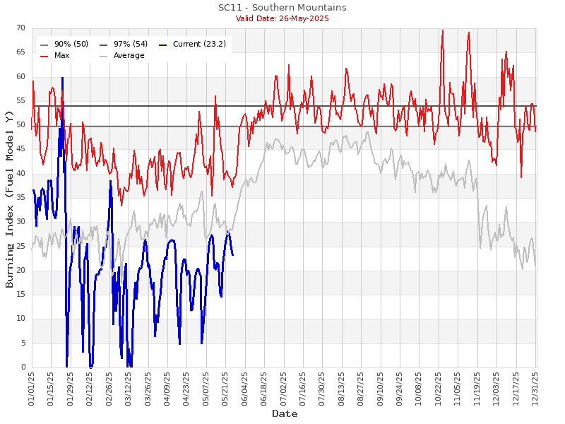
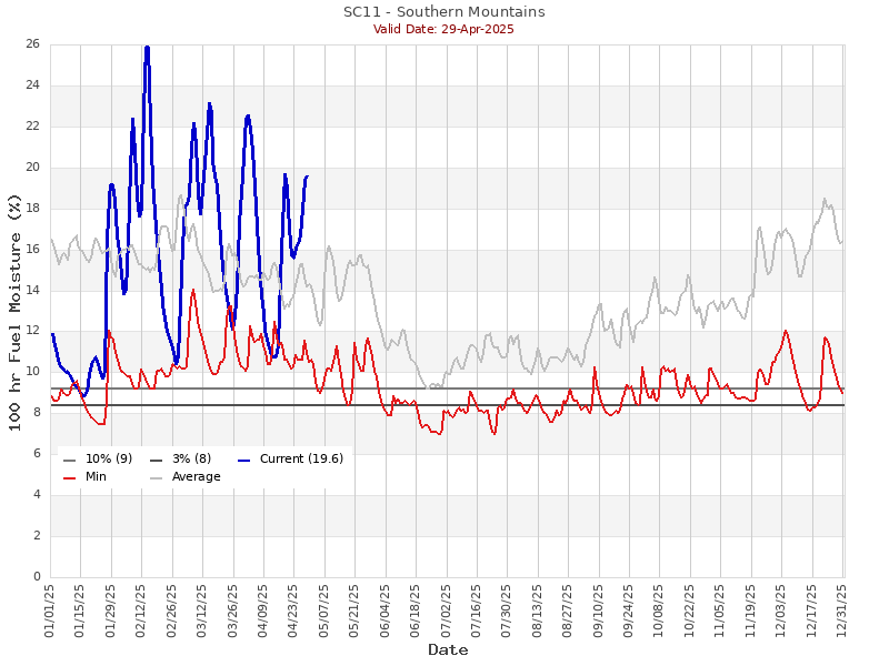
Regional Fuel Conditions
Burning Index
100-Hour Fuel Moisture
Additional Resources
Information Feeds
Infrastructure
California Transmission Lines Map
RxOpen (status of healthcare facilities in areas impacted by disasters)

