Peak Fire Incident Resource Page (2021 Fire)
Last Updated: July 23, 2021
Information per InciWeb
Start Date: July 20, 2021
Initial Location: North of Walker Basin Rd, south of community of Havilah
Initial Lat/Long: 35.406, -118.436
- Zip Codes Within a Radius from Initial Latitude / Longitude
- 10 Miles: 93518
20 Miles: 93518, 93205, 93531, 93240, 93283, 93285, 93561, 93581
Zip Code information pulled from FreeMapTools – Find ZIP Codes Inside a Radius
Resource Links
Fire Information
Fire Maps & Webcams
NASA FIRMS Satellite Fire Activity Map
NASA FIRMS – KMZ and Shapefiles of Satellite Fire Activity
AlertWildfire Webcam – Breckenridge Peak 2
AlertWildfire Webcam – Bird Springs 1
If CalTrans Webcam shows “Temporarily Unavailable” – This condition is caused by a problem communicating with the remote camera site to retrieve the picture (JPEG) image.
Additional Information Feeds
Fire Map
Air Quality & Smoke Links
US Forest Service BlueSky Daily Runs – Smoke Modeling
US Forest Service BlueSky Daily Runs KMZ and Map Files
AirNow EnviroFlash Map (includes alert notification signup option)
Weather
National Weather Service Watches, Warnings, and Advisories
Wind Map
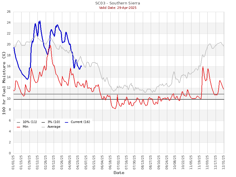
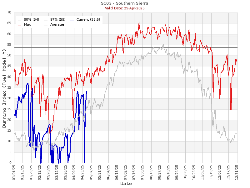
Regional Fuel Conditions
Burning Index
100-Hour Fuel Moisture