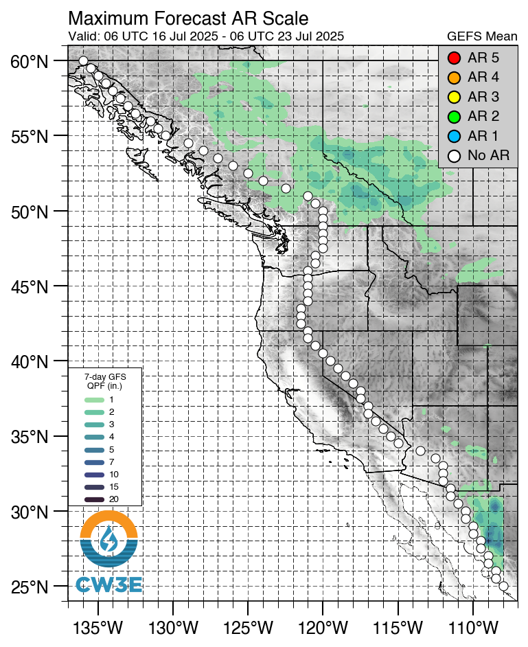
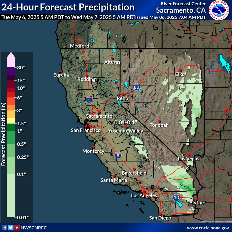
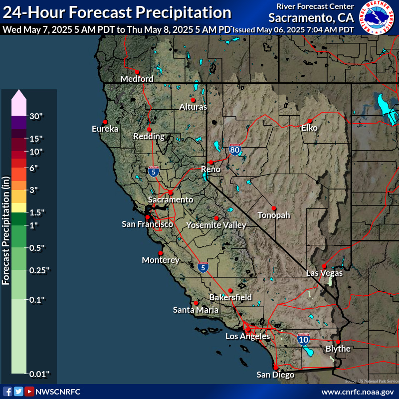
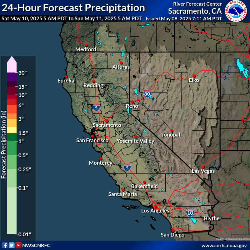
Atmospheric Rivers Quick Links Collection

Atmospheric rivers are among the most consequential weather phenomena affecting California — capable of delivering beneficial water supply and, at times, significant flooding, debris flows, infrastructure disruption, and cascading impacts.

This Quick Links page brings together authoritative forecast products, flood outlooks, and river monitoring tools to support situational awareness before and during atmospheric river events.

While the emphasis is on California, many of these tools apply more broadly to regions across the western United States impacted by atmospheric rivers.

Atmospheric rivers are relatively long, narrow regions in the atmosphere – like rivers in the sky – that transport most of the water vapor outside of the tropics. These columns of vapor move with the weather, carrying an amount of water vapor roughly equivalent to the average flow of water at the mouth of the Mississippi River. When the atmospheric rivers make landfall, they often release this water vapor in the form of rain or snow. (Source: NOAA)

Additional Resources:

NOAA’s page about Atmospheric Rivers

USGS’s 6 Things to Know about Atmospheric Rivers

Short video about atmospheric rivers by the Scripps Institution of Oceanography at UC San Diego.

Atmospheric River and Precipitation Forecasts

Maps from the Center for Western Weather and Water Extremes’ Atmospheric River Scale Forecast Products page. show atmospheric river scale forecasted over the next 7 days from the ensemble mean or control forecast at each dotted location. GEFS model plots are updated about every six hours and ECMWF model plots are update about every 12 hours. (Note – All model data provided courtesy of NOAA/NCEP or ECMWF. All products are considered experimental.)

US National Model (GEFS)
Coastal Region
Atmospheric River Forecast - Coastal Region, GEFS Model
Foothills Region
Atmospheric River Forecast - Foothills Region, GEFS Model
Inland Region
Atmospheric River Forecast - Inland Region, GEFS Model
European Model (ECMWF)
Coastal Region
Atmospheric River Forecast - Coastal Region, ECMWF Model
Foothills Region
Atmospheric River Forecast - Coastal Region, ECMWF Model
Inland Region
Atmospheric River Forecast - Coastal Region, ECMWF Model
Day 1 Rainfall
Day 1 Rainfall
Day 2 Rainfall
Day 2 Rainfall
Day 3 Rainfall
Day 3 Rainfall

Additional images are available for days 3-6 and for 6 hour intervals for days 1-3 at the California Nevada River Forecast Center page.

Excessive Rainfall & Flooding Hazards

Day 1 Outlook
Day 1 Excessive Rainfall Outlook Map
Day 2 Outlook
Day 2 Excessive Rainfall Outlook Map
Day 3 Outlook
Day 3 Excessive Rainfall Outlook Map

In the Excessive Rainfall Outlooks, the Weather Prediction Center (WPC) forecasts the probability that rainfall will exceed flash flood guidance (FFG) within 40 kilometers (25 miles) of a point.

High: Severe, widespread flash flooding. Areas that don’t normally experience flash flooding, could. Lives and property in greater danger.

Moderate: Numerous flash flooding events with significant events possible. Many streams may flood, potentially affecting larger rivers.

Slight (yellow): Mainly localized. Most vulnerable are urban areas, roads, small streams and washes. Isolated significant flash flooding possible.

Marginal: Localized and primarily affecting places that can experience rapid runoff with heavy rainfall.

You can access downloadable shape and KML files on the NOAA Weather Prediction Page for Excessive Rainfall

California Nevada River Forecast Center

In addition to providing current and forecast information on the larger rivers and creeks in California, GIS files are also available for download (links under the map)


USGS Current Water Data for California

USGS National Water Dashboard

USGS WaterAlerts

CNRFC Daily Briefing

National Flood Hazard Layer – This is a geospatial database that contains current effective flood hazard data. FEMA provides the flood hazard data to support the National Flood Insurance Program. You can use the information to better understand your level of flood risk and type of flooding.


FEMA Flood Map Service Center – enter address to get flood map for a specific area


Preliminary FEMA Map Products – Preliminary flood hazard data (preliminary data) provide the public an early look at their home or community‘s projected risk to flood hazards. Preliminary data may include: new or revised Flood Insurance Rate Maps (FIRM), Flood Insurance Study (FIS) reports, and FIRM Databases.


California Best Available Maps – These maps display 100- and 200-year floodplains for areas located within the Sacramento-San Joaquin (SAC-SJ) Valley watershed.


Levee Flood Protection Zone Maps – These maps developed by the State of California Department of Water Resources, estimate the maximum area that may be flooded if a State-Federal levee fails with flows at maximum capacity that may reasonably be conveyed. These maps specifically focus on flood risks associated with State-Federal levees.


Page Last Update: February 26, 2026